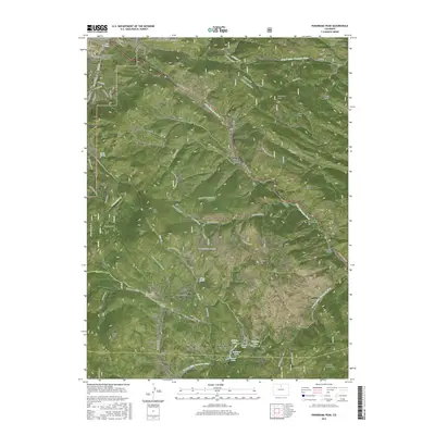
2016 Map of Panorama Peak
USGS Topo · Published 2016About this map
Estes Park and its eastern surroundings are defined by a complex network of high peaks and recreational trails within the Roosevelt National Forest. The landscape is centered on the drainage of the Little Thompson River and its various forks, featuring several mountain lakes such as Lake Estes and Mirror Lake. Significant human modification is evident through the presence of the Olympus Tunnel and Pole Hill Tunnel, alongside a detailed system of historic paths including the Homestead Meadows Trail and Lion Gulch Trail.
Find a feature on this map
84 named features on this map. Tap any name to fly to it.
Don’t see what you’re looking for? This feature index may not catch every label — zoom into the map to look around manually.
Map Details
Editions of this 2016 Panorama Peak Map
This is the sole edition of this map. No revisions or reprints were ever made.
Other maps of this area

1902 · Boulder
USGS Topo · 1:62,500

1904 · Boulder
USGS Topo · 1:62,500

1905 · Mount Olympus
USGS Topo · 1:62,500

1907 · Mount Olympus
USGS Topo · 1:62,500

1915 · Longs Peak
USGS Topo · 1:125,000

1919 · Rocky Mountain National Park
USGS Topo · 1:125,000

1954 · Greeley
USGS Topo · 1:250,000

1957 · Greeley
USGS Topo · 1:250,000

1957 · Allens Park
USGS Topo · 1:24,000
1957 · Raymond
USGS Topo · 1:24,000