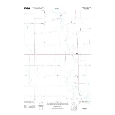
2013 Map of Panther
USGS Topo · Published 2013About this map
The N Raccoon River winds through the heart of Dallas County, Iowa, defining the drainage patterns for a landscape of agricultural sections and riparian corridors. In this 2013 survey, the small community of Panther and the intersection at Black Corners serve as the primary landmarks within a grid of county roads. The river’s importance to local recreation is evident through the inclusion of the Snyder Access and Highway Forty-Four Access, providing points of entry to the water. To the southeast, the terrain shifts toward more developed recreational and transit use, featuring the River Valley Golf Course and the Husband Field Airport. Numerous tributaries, including E Br Panther Cr and Hickory Cr, carve subtle valleys through the prairie, while Mill Slough marks a low-lying bypass along the main river channel.
Find a feature on this map
51 named features on this map. Tap any name to fly to it.
Don’t see what you’re looking for? This feature index may not catch every label — zoom into the map to look around manually.
Map Details
Editions of this 2013 Panther Map
This is the sole edition of this map. No revisions or reprints were ever made.
Other maps of this area

1908 · Waukee
USGS Topo · 1:62,500

1911 · Madrid
USGS Topo · 1:62,500

1914 · Madrid
USGS Topo · 1:62,500

1949 · Adel
USGS Topo · 1:62,500

1950 · Perry
USGS Topo · 1:62,500

1951 · Perry
USGS Topo · 1:62,500

1951 · Adel
USGS Topo · 1:62,500

1954 · Omaha
USGS Topo · 1:250,000

1954 · Des Moines
USGS Topo · 1:250,000

1956 · Des Moines
USGS Topo · 1:250,000