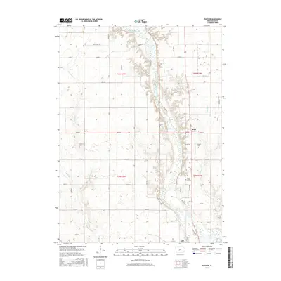
2015 Map of Panther
USGS Topo · Published 2015About this map
The North Raccoon River carves a winding path through the center of this central Iowa landscape, defining the topography between Panther and Adel. This 2015 survey reveals a deeply rooted rural community evidenced by its numerous cemeteries, including the Panther Creek Church of the Brethren Cem and the Dallas County Farm Cem. These sites, along with others like Oakdale Cem and Kinnick Cem, offer significant geographic markers for local family history and genealogical research. The river valley is flanked by agricultural lands and crossed by a network of rural roads such as Sportsmans Club Rd and Fairground Rd. The smaller settlement of Black Corners sits to the east of the river, while several branches of Panther Creek, including E Br Panther Cr and W Br Panther Cr, drain the western fields toward the main river channel. Husband Field stands out as a localized landmark in a region dominated by farm sections and riverine bends.
Find a feature on this map
48 named features on this map. Tap any name to fly to it.
Don’t see what you’re looking for? This feature index may not catch every label — zoom into the map to look around manually.
Map Details
Editions of this 2015 Panther Map
This is the sole edition of this map. No revisions or reprints were ever made.
Other maps of this area

1908 · Waukee
USGS Topo · 1:62,500

1911 · Madrid
USGS Topo · 1:62,500

1914 · Madrid
USGS Topo · 1:62,500

1949 · Adel
USGS Topo · 1:62,500

1950 · Perry
USGS Topo · 1:62,500

1951 · Perry
USGS Topo · 1:62,500

1951 · Adel
USGS Topo · 1:62,500

1954 · Omaha
USGS Topo · 1:250,000

1954 · Des Moines
USGS Topo · 1:250,000

1956 · Des Moines
USGS Topo · 1:250,000