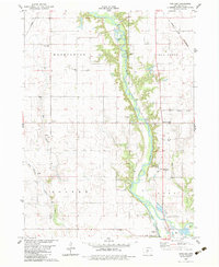
1982 Map of Panther
USGS Topo · Published 1983About this map
The North Raccoon River carves a deep valley through the center of this rural Dallas County landscape, shaping the boundaries between the townships of Washington, Sugar Grove, Colfax, and Adel. The agricultural character of the early 1980s is evident in the network of country churches and schools that anchored these farming communities, such as Washington Chapel, Brethren Ch, and Central Dallas Sch. Near the river's eastern bank, the Chicago and North Western railway runs toward the northeast, passing through Blacks Corners.
Find a feature on this map
27 named features on this map. Tap any name to fly to it.
Don’t see what you’re looking for? This feature index may not catch every label — zoom into the map to look around manually.
Map Details
Editions of this 1982 Panther Map
This is the sole edition of this map. No revisions or reprints were ever made.
Other maps of this area

1908 · Waukee
USGS Topo · 1:62,500

1911 · Madrid
USGS Topo · 1:62,500

1914 · Madrid
USGS Topo · 1:62,500

1949 · Adel
USGS Topo · 1:62,500

1950 · Perry
USGS Topo · 1:62,500

1951 · Perry
USGS Topo · 1:62,500

1951 · Adel
USGS Topo · 1:62,500

1954 · Omaha
USGS Topo · 1:250,000

1954 · Des Moines
USGS Topo · 1:250,000

1956 · Des Moines
USGS Topo · 1:250,000