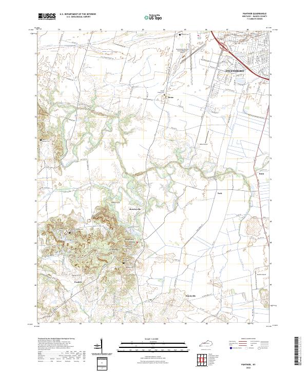
2022 Map of Panther
USGS Topo · Published 2022About this map
Owensboro expands southward into the agricultural landscape of Daviess County, where the transition from urban sprawl to rural settlement is marked by numerous family-named landmarks and historical cemeteries. The area is defined by a complex drainage system including Panther Creek, Old Panther Creek, and Vance Ditch, which navigate the low-lying terrain surrounding Island Field and Ditney Hill. Local genealogy is preserved in sites like Saint Raphael Cemetery and the Mount Zion Methodist Episcopal Church Cemetery, while the aviation history of the region is anchored by the Owensboro/Daviess County Regional Airport and smaller fields such as Miles Airport. Further south, the map details the smaller communities of Moseleyville, Panther, and Handyville, set against elevated features like Nickel Ridge and Nation Hill that break the prevailing flatlands of the creek basins.
Find a feature on this map
113 named features on this map. Tap any name to fly to it.
Don’t see what you’re looking for? This feature index may not catch every label — zoom into the map to look around manually.
Map Details
Editions of this 2022 Panther Map
This is the sole edition of this map. No revisions or reprints were ever made.
Historical Maps of Mid America Industrial Park Through Time
4 maps found