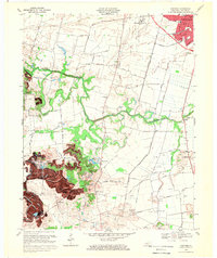
1968 Map of Panther
USGS Topo · Published 1970About this map
The Owensboro-Daviess Co Airport and the expanding southern reaches of Owensboro anchor the northern landscape of this late-1960s survey. The map records a rural infrastructure in transition, where family-named ridges like Nickel Ridge and Nation Hill stand alongside numerous Oil Wells and a growing network of roads including Old Lyddane Bridge Road and Marksbury Road.
Find a feature on this map
45 named features on this map. Tap any name to fly to it.
Don’t see what you’re looking for? This feature index may not catch every label — zoom into the map to look around manually.
Map Details
Editions of this 1968 Panther Map
2 editions found
Other maps of this area

1901 · Owensboro
USGS Topo · 1:62,500

1905 · Newburg
USGS Topo · 1:62,500

1906 · Sutherland
USGS Topo · 1:62,500

1908 · Calhoun
USGS Topo · 1:62,500

1952 · Owensboro East
USGS Topo · 1:24,000

1952 · Owensboro West
USGS Topo · 1:24,000

1952 · Reed
USGS Topo · 1:24,000

1952 · Calhoun
USGS Topo · 1:24,000

1953 · Sutherland
USGS Topo · 1:24,000

1953 · Utica
USGS Topo · 1:24,000