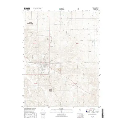
2016 Map of Paoli
USGS Topo · Published 2016About this map
Paoli serves as the focal point of this Orange County landscape, where the confluence of several key routes and the winding Lick Creek define the town's layout. The map highlights a transition from the structured street grid of the county seat to the outlying rural settlements of Woodlawn Grove, Syria, and Chambersburg. To the north, the Lost River meanders through a landscape dotted with family-named burial grounds including Irvin Cem, Scott Cem, and Lewis Cem. A unique hydrological feature, the Stampers Creek Sinks, appears to the northeast, illustrating the region's complex karst topography. Much of the southern and western portions are managed as part of the Hoosier National Forest, reflecting a terrain of ridges and valleys cut by streams like Youngs Creek and Willow Creek. The presence of the Indian Boundary Rd north of the town center provides a clear reference to the historical surveying and settlement patterns of southern Indiana.
Find a feature on this map
72 named features on this map. Tap any name to fly to it.
Don’t see what you’re looking for? This feature index may not catch every label — zoom into the map to look around manually.
Map Details
Editions of this 2016 Paoli Map
This is the sole edition of this map. No revisions or reprints were ever made.
Other maps of this area

1947 · Hardinsburg
USGS Topo · 1:24,000

1949 · Hardinsburg
USGS Topo · 1:24,000

1949 · Georgia
USGS Topo · 1:24,000

1950 · Mitchell
USGS Topo · 1:24,000

1950 · Valeene
USGS Topo · 1:24,000

1951 · French Lick
USGS Topo · 1:24,000

1951 · Georgia
USGS Topo · 1:24,000

1956 · Greenbrier
USGS Topo · 1:24,000

1956 · Vincennes
USGS Topo · 1:250,000

1957 · Vincennes
USGS Topo · 1:250,000