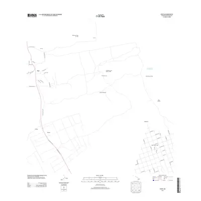
2013 Map of Papa
USGS Topo · Published 2013About this map
Volcanic activity and agricultural settlement define this coastal landscape on the Island of Hawai'i. The map documents a sequence of early 20th-century eruptions, including the Lava Flow of 1907, the Lava Flow of 1916, and the large 'Ālika Lava Flow of 1919, which dramatically reshaped the terrain. Amidst these geological markers, the small settlement of Pāpā and the Honomalino Camp illustrate the human presence in the region. Industrial activity is noted at the Koa Mill and Ohia Mill, likely tied to the timber or ranching operations of the era, such as those along Yee Hop Ranch Road 2. The southeastern portion of the map shows a modern grid system with street names like Island Blvd, Catamaran Ln, and Pineapple Pkwy, contrasting with the more dispersed rural landmarks like Wailohi and the One Hundred Acre Waterhole.
Find a feature on this map
47 named features on this map. Tap any name to fly to it.
Don’t see what you’re looking for? This feature index may not catch every label — zoom into the map to look around manually.
Map Details
Editions of this 2013 Papa Map
This is the sole edition of this map. No revisions or reprints were ever made.
Other maps of this area

1924 · Honuapo
USGS Topo · 1:62,500

1928 · Mauna Loa
USGS Topo · 1:62,500

1928 · Hoopuloa
USGS Topo · 1:62,500

1954 · Hawaii South
USGS Topo · 1:250,000

1959 · Hawaii South
USGS Topo · 1:250,000

1961 · Hawaii South
USGS Topo · 1:250,000

1962 · Hawaii South
USGS Topo · 1:250,000

1962 · Milolii
USGS Topo · 1:24,000

1962 · Kahuku Ranch
USGS Topo · 1:24,000
1962 · Manuka Bay
USGS Topo · 1:24,000