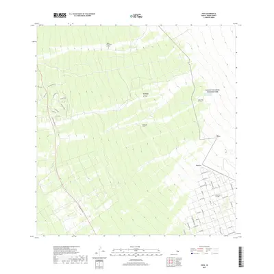
2017 Map of Papa
USGS Topo · Published 2017About this map
Successive historical eruptions define the landscape of Island of Hawai'i on this south-western coast. The survey documents several distinct volcanic events, including the Lava Flow of 1907 at the lower elevations and the Ho'opuloa Lava Flow of 1926 further north. These flows cut across the terrain toward the sea, intersecting older thoroughfares like Old Mamalahoa Hwy and modern residential developments.
Find a feature on this map
44 named features on this map. Tap any name to fly to it.
Don’t see what you’re looking for? This feature index may not catch every label — zoom into the map to look around manually.
Map Details
Editions of this 2017 Papa Map
This is the sole edition of this map. No revisions or reprints were ever made.
Other maps of this area

1924 · Honuapo
USGS Topo · 1:62,500

1928 · Mauna Loa
USGS Topo · 1:62,500

1928 · Hoopuloa
USGS Topo · 1:62,500

1954 · Hawaii South
USGS Topo · 1:250,000

1959 · Hawaii South
USGS Topo · 1:250,000

1961 · Hawaii South
USGS Topo · 1:250,000

1962 · Hawaii South
USGS Topo · 1:250,000

1962 · Milolii
USGS Topo · 1:24,000

1962 · Kahuku Ranch
USGS Topo · 1:24,000
1962 · Manuka Bay
USGS Topo · 1:24,000