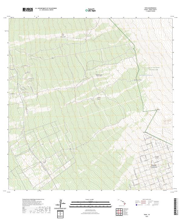
2024 Map of Papa
USGS Topo · Published 2024About this map
The volcanic landscape of the Island of Hawai'i is clearly defined here by the historic paths of molten rock that have shaped the district over decades. The map documents the specific footprints of the 'Ālika Lava Flow of 1919, the Ho'ōpūloa Lava Flow of 1926, and earlier events like the Lava Flow of 1916. These flows descend toward the coast, cutting through the terrain and dictating the modern road network. To the east, the boundary of Hawai'i Volcanoes National Park encompasses landmarks such as Puu Ohohia and the One Hundred-Acre Waterhole. In the southeast, the residential grid of Hawaiian Ocean View spans across the Lava Flow of 1907, showing how contemporary settlement has integrated with the island's active geological history. This record is essential for tracing local property lines and access routes like Papa Homestead Rd and the Old Mamalahoa Hwy.
Find a feature on this map
45 named features on this map. Tap any name to fly to it.
Don’t see what you’re looking for? This feature index may not catch every label — zoom into the map to look around manually.
Map Details
Editions of this 2024 Papa Map
This is the sole edition of this map. No revisions or reprints were ever made.
Other maps of this area

1924 · Honuapo
USGS Topo · 1:62,500

1928 · Mauna Loa
USGS Topo · 1:62,500

1928 · Hoopuloa
USGS Topo · 1:62,500

1954 · Hawaii South
USGS Topo · 1:250,000

1959 · Hawaii South
USGS Topo · 1:250,000

1961 · Hawaii South
USGS Topo · 1:250,000

1962 · Hawaii South
USGS Topo · 1:250,000

1962 · Milolii
USGS Topo · 1:24,000

1962 · Kahuku Ranch
USGS Topo · 1:24,000
1962 · Manuka Bay
USGS Topo · 1:24,000