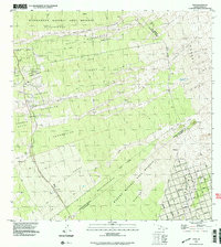
1995 Map of Papa
USGS Topo · Published 2000About this map
The Alika Lava Flow of 1919 and the Ho'opuloa Lava Flow of 1926 dominate this South Kona landscape, illustrating the raw geologic forces that define the Big Island's western slopes. Settlement patterns here are dictated by these volcanic events, with the Alika Homesteads and Papa 1 Homesteads occupying the strips of older land between more recent flows. At the coast, the Ho'opuloa Church & Monument stands as a quiet marker of communities impacted by the shifting earth.
Find a feature on this map
50 named features on this map. Tap any name to fly to it.
Don’t see what you’re looking for? This feature index may not catch every label — zoom into the map to look around manually.
Map Details
Editions of this 1995 Papa Map
This is the sole edition of this map. No revisions or reprints were ever made.
Other maps of this area

1924 · Honuapo
USGS Topo · 1:62,500

1928 · Mauna Loa
USGS Topo · 1:62,500

1928 · Hoopuloa
USGS Topo · 1:62,500

1954 · Hawaii South
USGS Topo · 1:250,000

1959 · Hawaii South
USGS Topo · 1:250,000

1961 · Hawaii South
USGS Topo · 1:250,000

1962 · Hawaii South
USGS Topo · 1:250,000

1962 · Milolii
USGS Topo · 1:24,000

1962 · Kahuku Ranch
USGS Topo · 1:24,000
1962 · Manuka Bay
USGS Topo · 1:24,000