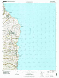
1994 Map of Papaikou
USGS Topo · Published 1998About this map
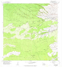
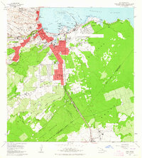
Coastal sugar plantations and historic settlements dominate this stretch of the Hamakua Coast in the mid-1990s. The landscape is defined by the legacy of the sugar industry, centered around the Pepeekeo Mill and various residential clusters like Andrade Camp. Settlement patterns are distinctly organized into homestead districts such as Kaupakuea Homesteads and Kulaimano Homesteads, which sit on the uplands above the Pacific bluffs. Transportation and infrastructure are concentrated along the coastline, including the Pepeekeo Airstrip and a Communication Tower near Pepeekeo Point. Several cultural landmarks are visible, from the Mauna Kea Memorial Park and Alae Cemetery to community gathering spots like Kolekole Beach Park near Wailea. The map documents the intricate network of gulches and streams, such as Kapehu, that cut through the agricultural lands towards Hilo Bay.
Find a feature on this map
90 named features on this map. Tap any name to fly to it.
Don’t see what you’re looking for? This feature index may not catch every label — zoom into the map to look around manually.
Map Details
Editions of this 1994 Papaikou Map
This is the sole edition of this map. No revisions or reprints were ever made.
Other maps of this area
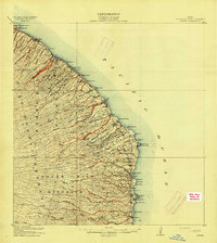
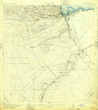
1915 · Honomu
USGS Topo · 1:62,500
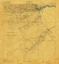
1917 · Hilo
USGS Topo · 1:62,500
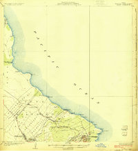
1924 · Makuu
USGS Topo · 1:62,500
1932 · Hilo
USGS Topo · 1:62,500

1954 · Hawaii North
USGS Topo · 1:250,000

1959 · Hawaii North
USGS Topo · 1:250,000

1961 · Hawaii North
USGS Topo · 1:250,000
1963 · Piihonua
USGS Topo · 1:24,000
1963 · Hilo
USGS Topo · 1:24,000
1963 · Keaau Ranch
USGS Topo · 1:24,000