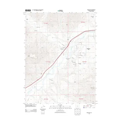
2013 Map of Parachute
USGS Topo · Published 2013About this map
Parachute sits at the confluence of Parachute Creek and the Colorado River, serving as a focal point for this Garfield County landscape. The map illustrates a complex network of agricultural and industrial water management, featuring named irrigation channels like Low Cost Ditch, Daisy Ditch, and Diamond Ditch that lace the valley floor. High above the river, the residential layout of Battlement Mesa is clearly defined, contrasting with the more sparse settlement at Una to the southwest.
Find a feature on this map
56 named features on this map. Tap any name to fly to it.
Don’t see what you’re looking for? This feature index may not catch every label — zoom into the map to look around manually.
Map Details
Editions of this 2013 Parachute Map
This is the sole edition of this map. No revisions or reprints were ever made.
Other maps of this area

1906 · Grand Hogback
USGS Topo · 1:125,000

1910 · Grand Hogback
USGS Topo · 1:125,000

1925 · Parachute Creek
USGS Topo · 1:62,500

1927 · Parachute Creek
USGS Topo · 1:62,500

1929 · Grand Valley
USGS Topo · 1:62,500

1952 · Anvil Points
USGS Topo · 1:24,000

1956 · Grand Junction
USGS Topo · 1:250,000

1957 · Leadville
USGS Topo · 1:250,000

1959 · Grand Junction
USGS Topo · 1:250,000

1959 · Leadville
USGS Topo · 1:250,000