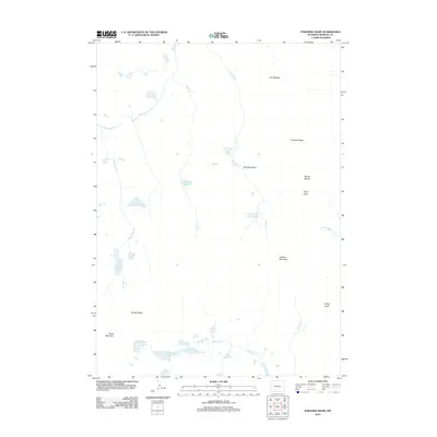
2012 Map of Paradise Basin
USGS Topo · Published 2012About this map
Paradise Basin sits at the heart of this high-elevation landscape in Fremont County, defined by a complex network of glacial lakes and mountain peaks. The drainage patterns of Sheep Cr and Paradise Cr weave through the terrain, connecting a series of alpine water bodies including Lydie Lake, Steamboat Lake, and the remote Paradise Lakes. The eastern edge of the quadrangle is anchored by a line of significant summits, including Mount Windy, Tybo Peak, and Lookout Mountain, providing a clear view of the high-country topography before the descent toward Saint Lawrence Cr. To the south, the terrain flattens slightly into areas like Elk Meadow and the shores of Elk Lake and Tigee Lake. This 2012 survey captures a wilderness area shaped by its hydrography, where numerous unnamed tarns sit alongside prominent features like Windy Ridge and Horse Mountain.
Find a feature on this map
26 named features on this map. Tap any name to fly to it.
Don’t see what you’re looking for? This feature index may not catch every label — zoom into the map to look around manually.
Map Details
Editions of this 2012 Paradise Basin Map
This is the sole edition of this map. No revisions or reprints were ever made.
Other maps of this area

1937 · Moccasin Lake
USGS Topo · 1:48,000

1938 · Mt Bonneville
USGS Topo · 1:62,500

1941 · Mt Bonneville
USGS Topo · 1:62,500

1942 · Mt Bonneville
USGS Topo · 1:62,500

1943 · Moccasin Lake
USGS Topo · 1:62,500

1952 · Bob Lakes
USGS Topo · 1:24,000

1952 · Bull Lake West
USGS Topo · 1:24,000

1952 · Kirkland Park
USGS Topo · 1:24,000

1952 · Paradise Basin
USGS Topo · 1:24,000

1952 · St. Lawrence Basin
USGS Topo · 1:24,000