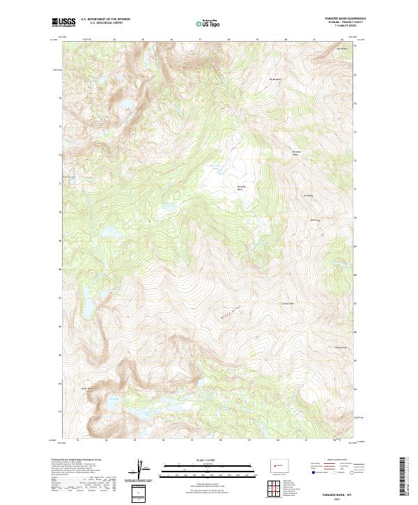
2021 Map of Paradise Basin
USGS Topo · Published 2021About this map
Paradise Basin sits at the heart of this high-elevation landscape in Fremont County, where a complex network of alpine water bodies defines the geography. Numerous lakes, including Lydle Lake, Paradise Lakes, and Upper Paradise Lake, are fed by the drainages of Paradise Cr and Sheep Cr. The area is characterized by significant topographic relief, with prominent landmarks such as Wittombona Peak and Mt Windy rising above the basin floor.
Find a feature on this map
32 named features on this map. Tap any name to fly to it.
Don’t see what you’re looking for? This feature index may not catch every label — zoom into the map to look around manually.
Map Details
Editions of this 2021 Paradise Basin Map
This is the sole edition of this map. No revisions or reprints were ever made.
Other maps of this area

1937 · Moccasin Lake
USGS Topo · 1:48,000

1938 · Mt Bonneville
USGS Topo · 1:62,500

1941 · Mt Bonneville
USGS Topo · 1:62,500

1942 · Mt Bonneville
USGS Topo · 1:62,500

1943 · Moccasin Lake
USGS Topo · 1:62,500

1952 · Bob Lakes
USGS Topo · 1:24,000

1952 · Bull Lake West
USGS Topo · 1:24,000

1952 · Kirkland Park
USGS Topo · 1:24,000

1952 · Paradise Basin
USGS Topo · 1:24,000

1952 · St. Lawrence Basin
USGS Topo · 1:24,000