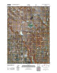
2011 Map of Paradise Mountain
USGS Topo · Published 2011About this map
Paradise Mountain and the expansive volcanic plateau of the Devils Garden define this high-desert ranching landscape in southern Oregon. At the start of the 21st century, the area remains dominated by large-scale land holdings such as Casebeer Ranch, Paradise Ranch, and Round Grove Ranch, reflecting the enduring cattle and grazing economy of the region. Water management is critical in this arid terrain, as evidenced by a network of engineered catchments including Little Reservoir Number One and Little Reservoir Number Three along Paradise Creek. For aviation historians or local researchers, the remote Wilderness Airport near the South Fork Sprague River marks a notable point of infrastructure in an otherwise sparse landscape of valleys and springs like Jims Valley and Tank Spring.
Find a feature on this map
19 named features on this map. Tap any name to fly to it.
Don’t see what you’re looking for? This feature index may not catch every label — zoom into the map to look around manually.
Map Details
Editions of this 2011 Paradise Mountain Map
This is the sole edition of this map. No revisions or reprints were ever made.
Other maps of this area

1889 · Klamath
USGS Topo · 1:250,000

1894 · Klamath
USGS Topo · 1:250,000

1955 · Klamath Falls
USGS Topo · 1:250,000

1958 · Klamath Falls
USGS Topo · 1:250,000

1960 · Gerber Reservoir
USGS Topo · 1:62,500

1960 · Bly
USGS Topo · 1:62,500

1960 · Strawberry Butte
USGS Topo · 1:62,500

1960 · Fishhole Mtn
USGS Topo · 1:62,500

1975 · Lakeview
USGS Topo · 1:100,000
1988 · Arkansas Flat
USGS Topo · 1:24,000