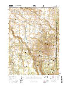
2014 Map of Paradise Mountain
USGS Topo · Published 2014About this map
Paradise Mountain and the surrounding high-desert plateaus of Fremont National Forest dominate this landscape on the eastern edge of Klamath County. The terrain is defined by a series of high valleys and seasonal water systems, including Jims Valley and Lost Valley. Water management is central to the area's geography, evidenced by a numbered sequence of catchments such as Little Reservoir Number One, Little Reservoir Number Three, and Little Reservoir Number Five. These reservoirs, along with the headwaters of the S Fork Sprague River, support a remote ecosystem and local land use. Transportation is anchored by the Klamath Falls-Lakeview Hwy, which provides access through this sparsely populated territory. The presence of the Wilderness Airport suggests the historical necessity of aviation for reaching this isolated segment of the Oregon backcountry near the Lake County line.
Find a feature on this map
28 named features on this map. Tap any name to fly to it.
Don’t see what you’re looking for? This feature index may not catch every label — zoom into the map to look around manually.
Map Details
Editions of this 2014 Paradise Mountain Map
This is the sole edition of this map. No revisions or reprints were ever made.
Other maps of this area

1889 · Klamath
USGS Topo · 1:250,000

1894 · Klamath
USGS Topo · 1:250,000

1955 · Klamath Falls
USGS Topo · 1:250,000

1958 · Klamath Falls
USGS Topo · 1:250,000

1960 · Gerber Reservoir
USGS Topo · 1:62,500

1960 · Bly
USGS Topo · 1:62,500

1960 · Strawberry Butte
USGS Topo · 1:62,500

1960 · Fishhole Mtn
USGS Topo · 1:62,500

1975 · Lakeview
USGS Topo · 1:100,000
1988 · Arkansas Flat
USGS Topo · 1:24,000