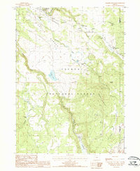
1988 Map of Paradise Mountain
USGS Topo · Published 1988About this map
The high plateau of Devils Garden defines the northern reaches of this territory in the late 1980s, where the S Fork Sprague R winds through a landscape marked by early timber and ranching infrastructure. This provisional survey captures the transition from the open valley near the Sprague River Picnic Area to the dense timber of the Fremont National Forest. Evidence of historical industry is visible in the Old Railroad Grade and a Wooden Pole Trans Line that cut across the northern sections, tracing old routes of transport and utility.
Find a feature on this map
27 named features on this map. Tap any name to fly to it.
Don’t see what you’re looking for? This feature index may not catch every label — zoom into the map to look around manually.
Map Details
Editions of this 1988 Paradise Mountain Map
This is the sole edition of this map. No revisions or reprints were ever made.
Other maps of this area

1889 · Klamath
USGS Topo · 1:250,000

1894 · Klamath
USGS Topo · 1:250,000

1955 · Klamath Falls
USGS Topo · 1:250,000

1958 · Klamath Falls
USGS Topo · 1:250,000

1960 · Gerber Reservoir
USGS Topo · 1:62,500

1960 · Bly
USGS Topo · 1:62,500

1960 · Strawberry Butte
USGS Topo · 1:62,500

1960 · Fishhole Mtn
USGS Topo · 1:62,500

1975 · Lakeview
USGS Topo · 1:100,000
1988 · Arkansas Flat
USGS Topo · 1:24,000