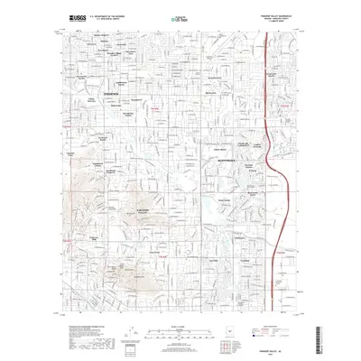
2018 Map of Paradise Valley
USGS Topo · Published 2018About this map
Camelback Mtn and the Phoenix Mountains dominate the landscape in this detailed 2018 survey of the affluent suburbs north of central Phoenix. This area, encompassing Paradise Valley and western Scottsdale, is characterized by high-density residential development, golf courses, and preserved natural landmarks. Notable geological features like The Praying Monk, Camels Eye, and Mummy Mtn are clearly delineated, providing a sense of the dramatic elevation changes within the city limits.
Find a feature on this map
62 named features on this map. Tap any name to fly to it.
Don’t see what you’re looking for? This feature index may not catch every label — zoom into the map to look around manually.
Map Details
Editions of this 2018 Paradise Valley Map
This is the sole edition of this map. No revisions or reprints were ever made.
Other maps of this area

1904 · Camelback
USGS Topo · 1:62,500

1906 · Camelsback
USGS Topo · 1:62,500

1912 · Phoenix
USGS Topo · 1:62,500

1913 · Mesa
USGS Topo · 1:62,500

1914 · Phoenix
USGS Topo · 1:62,500

1915 · Mesa
USGS Topo · 1:62,500

1930 · Cave Creek
USGS Topo · 1:125,000

1939 · Cave Creek
USGS Topo · 1:125,000

1952 · Tempe
USGS Topo · 1:24,000
1952 · Mesa
USGS Topo · 1:24,000