
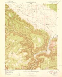
1949 Map of Paradox
USGS Topo · Published 1949About this map
The Paradox Valley floor and the surrounding high mesas dominate this 1940s landscape, reflecting the rugged isolation of Montrose County just before the regional uranium boom intensified. At the tiny settlements of Paradox and Bedrock, early agricultural efforts are evidenced by the intricate network of ditches feeding off West Paradox Creek. The topography transitions sharply from the valley floor to the massive elevations of Sinwadger Mesa and Wray Mesa, where a Stock Trail snakes through the high country.
Find a feature on this map
17 named features on this map. Tap any name to fly to it.
Don’t see what you’re looking for? This feature index may not catch every label — zoom into the map to look around manually.
Map Details
Editions of this 1949 Paradox Map
2 editions found
Other maps of this area

1885 · La Sal
USGS Topo · 1:250,000

1916 · Paradox Valley
USGS Topo · 1:125,000

1922 · Paradox Valley
USGS Topo · 1:125,000

1948 · Roc Creek
USGS Topo · 1:24,000

1948 · Bull Canyon
USGS Topo · 1:24,000

1948 · Paradox
USGS Topo · 1:24,000

1949 · Bull Canyon
USGS Topo · 1:24,000

1949 · Davis Mesa
USGS Topo · 1:24,000

1949 · Roc Creek
USGS Topo · 1:24,000

1949 · Red Canyon
USGS Topo · 1:24,000