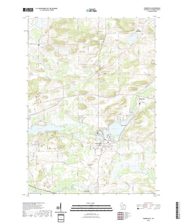
2022 Map of Pardeeville
USGS Topo · Published 2022About this map
The Fox River flows through the heart of this landscape, connecting the significant wetlands and lakes of Columbia County. The village of Pardeeville sits at the junction of Park Lake and Spring Lake, serving as a central hub for the surrounding rural townships. To the south, the settlement of Wyocena is positioned along the banks of Duck Creek, while smaller communities like Belle Fountain and Marcellon occupy the northeastern reaches.
Find a feature on this map
85 named features on this map. Tap any name to fly to it.
Don’t see what you’re looking for? This feature index may not catch every label — zoom into the map to look around manually.
Map Details
Editions of this 2022 Pardeeville Map
This is the sole edition of this map. No revisions or reprints were ever made.
Other maps of this area

1901 · Poynette
USGS Topo · 1:62,500

1902 · Portage
USGS Topo · 1:62,500

1955 · Randolph
USGS Topo · 1:62,500

1955 · Columbus
USGS Topo · 1:62,500

1957 · Madison
USGS Topo · 1:250,000

1960 · Madison
USGS Topo · 1:250,000

1962 · Poynette
USGS Topo · 1:62,500

1962 · Portage
USGS Topo · 1:62,500
1980 · Rio
USGS Topo · 1:24,000
1980 · Marquette
USGS Topo · 1:24,000