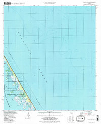
1994 Map of Pardon Island
USGS Topo · Published 1998About this map
Merritt Island sits at the intersection of aerospace history and coastal preservation on this mid-1990s survey. The map details the northern reaches of the John F Kennedy Space Center (NASA), where the high-technology infrastructure of the space program meets the protected marshes and waterways of the Merritt Island National Wildlife Refuge. The narrow barrier strip between Mosquito Lagoon and the Atlantic Ocean is preserved as part of the Canaveral National Seashore, showing a landscape remarkably free of the commercial development found elsewhere on the Florida coast.
Find a feature on this map
17 named features on this map. Tap any name to fly to it.
Don’t see what you’re looking for? This feature index may not catch every label — zoom into the map to look around manually.
Map Details
Editions of this 1994 Pardon Island Map
This is the sole edition of this map. No revisions or reprints were ever made.
Other maps of this area

1949 · Oak Hill
USGS Topo · 1:24,000

1949 · Pardon Island
USGS Topo · 1:24,000

1949 · Wilson
USGS Topo · 1:24,000

1949 · Mims
USGS Topo · 1:24,000

1950 · Ariel
USGS Topo · 1:24,000

1952 · Mims
USGS Topo · 1:24,000

1952 · Wilson
USGS Topo · 1:24,000
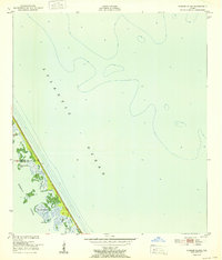
1952 · Pardon Island
USGS Topo · 1:24,000

1955 · Orlando
USGS Topo · 1:250,000

1957 · Orlando
USGS Topo · 1:250,000