
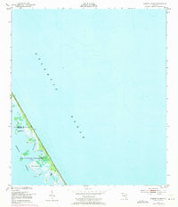
1949 Map of Pardon Island
USGS Topo · Published 1958About this map
Pardon Island and the surrounding marshy wetlands of Mosquito Lagoon dominate this mid-century coastal survey. Positioned along the Florida coastline where the Volusia and Brevard County line intersects the shore, the map reveals a complex system of barrier islands and shallow waterways. Key coastal features include the winding Pardon Slough, Widgeon Bay, and the interestingly named Three Cabbage Island. A solitary Tower stands as a navigational landmark on the narrow strip of land separating the lagoon from the Atlantic Ocean. The topography is characterized by intricate tidal flats and small landmasses like Scorpion, providing a detailed record of the shoreline before significant modern development altered the region's natural hydrography.
Find a feature on this map
9 named features on this map. Tap any name to fly to it.
Don’t see what you’re looking for? This feature index may not catch every label — zoom into the map to look around manually.
Map Details
Editions of this 1949 Pardon Island Map
4 editions found
Other maps of this area

1949 · Oak Hill
USGS Topo · 1:24,000

1949 · Wilson
USGS Topo · 1:24,000

1949 · Mims
USGS Topo · 1:24,000

1950 · Ariel
USGS Topo · 1:24,000

1952 · Mims
USGS Topo · 1:24,000

1952 · Wilson
USGS Topo · 1:24,000
1952 · Pardon Island
USGS Topo · 1:24,000

1955 · Orlando
USGS Topo · 1:250,000

1957 · Orlando
USGS Topo · 1:250,000

1958 · Orlando
USGS Topo · 1:250,000