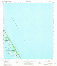
1949 Map of Pardon Island
USGS Topo · Published 1971About this map
The John F Kennedy Space Center (NASA) dominates this coastal stretch of Florida, where the barrier island landscape is defined by the expanse of the Atlantic Ocean to the east and the sheltered waters of the Mosquito Lagoon to the west. This 1949 survey, with revisions from 1970, captures the interface of federal space-age infrastructure and the original marshy terrain of the Volusia and Brevard county line. Landmarks like Pardon Island and Three Cabbage Island are surrounded by a network of tidal features including Pardon Slough and Widgeon Bay. The presence of a Tower and the isolated designations of Pardon and Scorpion reflect a landscape in transition, where old coastal place names remain even as the area became a focal point for the nation's space program.
Find a feature on this map
12 named features on this map. Tap any name to fly to it.
Don’t see what you’re looking for? This feature index may not catch every label — zoom into the map to look around manually.
Map Details
Editions of this 1949 Pardon Island Map
4 editions found
Other maps of this area

1949 · Oak Hill
USGS Topo · 1:24,000

1949 · Pardon Island
USGS Topo · 1:24,000

1949 · Wilson
USGS Topo · 1:24,000

1949 · Mims
USGS Topo · 1:24,000

1950 · Ariel
USGS Topo · 1:24,000

1952 · Mims
USGS Topo · 1:24,000

1952 · Wilson
USGS Topo · 1:24,000
1952 · Pardon Island
USGS Topo · 1:24,000

1955 · Orlando
USGS Topo · 1:250,000

1957 · Orlando
USGS Topo · 1:250,000