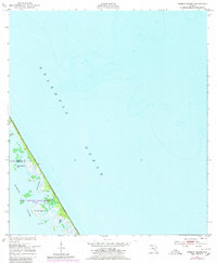
1949 Map of Pardon Island
USGS Topo · Published 1980About this map
John F Kennedy Space Center (NASA) territory occupies the lower portion of this coastal survey, highlighting the strategic military and scientific importance of this stretch of the Florida coastline. Originally mapped in 1949 and photorevised in 1970, the map illustrates the intricate barrier island ecosystem where the Atlantic Ocean meets the labyrinthine waters of the Mosquito Lagoon. The landscape is dominated by tidal marshes and small landmasses such as Pardon Island, Three Cabbage Island, and the named points of Scorpion and Pardon. These features are separated by a complex network of waterways including Pardon Slough, Widgeon Bay, and a man-made Ditch, reflecting a period of transition as the area became increasingly dedicated to aerospace operations. The boundary between Volusia Co and Brevard Co bisects the islands, providing a clear reference for local historical and jurisdictional research.
Find a feature on this map
13 named features on this map. Tap any name to fly to it.
Don’t see what you’re looking for? This feature index may not catch every label — zoom into the map to look around manually.
Map Details
Editions of this 1949 Pardon Island Map
4 editions found
Other maps of this area

1949 · Oak Hill
USGS Topo · 1:24,000

1949 · Pardon Island
USGS Topo · 1:24,000

1949 · Wilson
USGS Topo · 1:24,000

1949 · Mims
USGS Topo · 1:24,000

1950 · Ariel
USGS Topo · 1:24,000

1952 · Mims
USGS Topo · 1:24,000

1952 · Wilson
USGS Topo · 1:24,000
1952 · Pardon Island
USGS Topo · 1:24,000

1955 · Orlando
USGS Topo · 1:250,000

1957 · Orlando
USGS Topo · 1:250,000