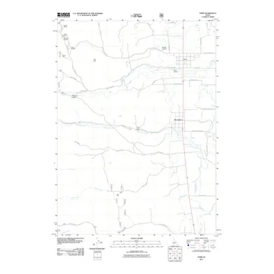
2011 Map of Paris
USGS Topo · Published 2011About this map
Paris and Bloomington anchor this corner of Bear Lake County, where the valley floor meets the eastern foothills of the Bear River Range. The settlement pattern is defined by a grid of agricultural roads like Dingle Bottoms Rd and Bloomington Bottoms Rd, serving a landscape deeply tied to the canyon systems that drain the high country. Resource extraction and water management are evident throughout the terrain, from the Boulder Mine located near First Hollow to the Clark Mine situated further south along Worm Creek. The hydrology of the area is particularly distinct, marked by numerous named springs such as Paris Spring, Jarvis Spring, and Crib Spring. These water sources feed into Paris Creek and Bloomington Creek as they emerge from Paris Canyon and Little Canyon, providing the vital irrigation needed for the valley's farmsteads and rural livelihoods.
Find a feature on this map
44 named features on this map. Tap any name to fly to it.
Don’t see what you’re looking for? This feature index may not catch every label — zoom into the map to look around manually.
Map Details
Editions of this 2011 Paris Map
This is the sole edition of this map. No revisions or reprints were ever made.
Other maps of this area

1909 · Montpelier
USGS Topo · 1:125,000

1911 · Montpelier
USGS Topo · 1:125,000

1915 · Preston
USGS Topo · 1:96,000

1918 · Preston
USGS Topo · 1:125,000

1955 · Preston
USGS Topo · 1:250,000

1958 · Preston
USGS Topo · 1:250,000

1962 · Preston
USGS Topo · 1:250,000

1967 · Montpelier
USGS Topo · 1:24,000

1967 · Paris
USGS Topo · 1:24,000

1967 · Ovid
USGS Topo · 1:24,000