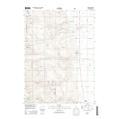
2013 Map of Paris
USGS Topo · Published 2013About this map
Paris and Bloomington serve as the primary anchors of this Bear Valley landscape, situated where the western mountain canyons meet the agricultural flats. The transition from the high ridges of the Cache National Forest to the valley floor is defined by a series of dramatic drainages, including Sleight Canyon, Paris Canyon, and Little Canyon. The 2013 survey illustrates the importance of water management in this high-altitude valley, tracing the routes of Paris Creek, Bloomington Creek, and Worm Creek as they flow eastward from the mountains toward the lowland bottoms. A network of secondary roads, such as Paris Cemetery Rd and Bloomington Bottoms Rd, connects the tight-knit residential grids of the towns to the surrounding rangeland and forest. The presence of Paris Spring and Crib Spring highlights the vital natural water sources that have supported this community for generations.
Find a feature on this map
63 named features on this map. Tap any name to fly to it.
Don’t see what you’re looking for? This feature index may not catch every label — zoom into the map to look around manually.
Map Details
Editions of this 2013 Paris Map
This is the sole edition of this map. No revisions or reprints were ever made.
Other maps of this area

1909 · Montpelier
USGS Topo · 1:125,000

1911 · Montpelier
USGS Topo · 1:125,000

1915 · Preston
USGS Topo · 1:96,000

1918 · Preston
USGS Topo · 1:125,000

1955 · Preston
USGS Topo · 1:250,000

1958 · Preston
USGS Topo · 1:250,000

1962 · Preston
USGS Topo · 1:250,000

1967 · Montpelier
USGS Topo · 1:24,000

1967 · Paris
USGS Topo · 1:24,000

1967 · Ovid
USGS Topo · 1:24,000