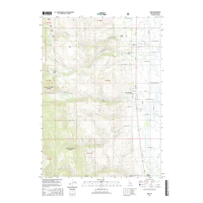
2017 Map of Paris
USGS Topo · Published 2017About this map
The eastern foothills of the Cache National Forest meet the Bear Lake Valley in this survey of Idaho's southeastern corner. This area is characterized by a series of steep canyons and hollows, including Sleight Canyon, Paris Canyon, and Telegraph Hollow, which channel runoff from the high terrain into the valley floor. The settlements of Paris, Bloomington, and Saint Charles are established along the transition where the mountain streams meet the flatter agricultural lands.
Find a feature on this map
100 named features on this map. Tap any name to fly to it.
Don’t see what you’re looking for? This feature index may not catch every label — zoom into the map to look around manually.
Map Details
Editions of this 2017 Paris Map
This is the sole edition of this map. No revisions or reprints were ever made.
Other maps of this area

1909 · Montpelier
USGS Topo · 1:125,000

1911 · Montpelier
USGS Topo · 1:125,000

1915 · Preston
USGS Topo · 1:96,000

1918 · Preston
USGS Topo · 1:125,000

1955 · Preston
USGS Topo · 1:250,000

1958 · Preston
USGS Topo · 1:250,000

1962 · Preston
USGS Topo · 1:250,000

1967 · Montpelier
USGS Topo · 1:24,000

1967 · Paris
USGS Topo · 1:24,000

1967 · Ovid
USGS Topo · 1:24,000