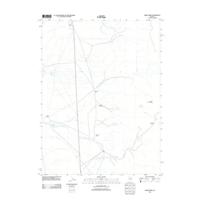
2012 Map of Paris Creek
USGS Topo · Published 2012About this map
Stratton Ranch and other remote outposts define the high-desert landscape of Elko County as it appeared in the early 21st century. The map centers on the drainage systems of Snow Cr and Paris Cr, where human presence is marked by isolated cattle ranching infrastructure and critical water sources. These focal points, including Snow Creek Ranch and Paris Ranch, are situated within a basin-and-range topography flanked by the Cherry Creek Range to the east.
Find a feature on this map
17 named features on this map. Tap any name to fly to it.
Don’t see what you’re looking for? This feature index may not catch every label — zoom into the map to look around manually.
Map Details
Editions of this 2012 Paris Creek Map
This is the sole edition of this map. No revisions or reprints were ever made.
Other maps of this area

1955 · Elko
USGS Topo · 1:250,000

1956 · Ely
USGS Topo · 1:250,000

1958 · Elko
USGS Topo · 1:250,000

1959 · Ely
USGS Topo · 1:250,000

1962 · Elko
USGS Topo · 1:250,000

1963 · Ely
USGS Topo · 1:250,000

1965 · Elko
USGS Topo · 1:250,000

1982 · Ninemile Well
USGS Topo · 1:24,000

1982 · Exchequer Spring
USGS Topo · 1:24,000
1982 · Cherry Creek Station
USGS Topo · 1:24,000