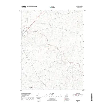
2019 Map of Paris East
USGS Topo · Published 2019About this map
Stoner Creek meanders through the heart of this Bluegrass region landscape, carving a winding path through the fertile terrain east of Paris. The map highlights the transition from the city's eastern edge to the established agricultural estates and farms that define Bourbon County. Large landholdings like Winburn Farm and Muckross Farm are prominent features alongside historical family landmarks such as Clay Cem.
Find a feature on this map
41 named features on this map. Tap any name to fly to it.
Don’t see what you’re looking for? This feature index may not catch every label — zoom into the map to look around manually.
Map Details
Editions of this 2019 Paris East Map
This is the sole edition of this map. No revisions or reprints were ever made.
Other maps of this area

1927 · Lexington
USGS Topo · 1:48,000

1929 · Cynthiana
USGS Topo · 1:48,000

1929 · Lexington
USGS Topo · 1:62,500

1934 · Cynthiana
USGS Topo · 1:62,500

1952 · Paris East
USGS Topo · 1:24,000

1952 · Clintonville
USGS Topo · 1:24,000

1952 · Austerlitz
USGS Topo · 1:24,000

1952 · North Middletown
USGS Topo · 1:24,000
1952 · Sideview
USGS Topo · 1:24,000

1953 · Carlisle
USGS Topo · 1:24,000