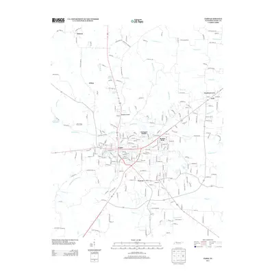
2013 Map of Paris
USGS Topo · Published 2013About this map
The street grid and neighborhoods of Paris anchor this regional study, showing the city's expansion through residential developments like Chickasaw Heights, Meadow Mead, and Porter Court. Beyond the urban center, the landscape is defined by the headwaters of the Middle Fork Obion River and a network of creeks including Thompson Cr, Bailey Fork Cr, and Clifty Cr. The map details the transition from the concentrated commercial and residential blocks of the county seat to outlying settlements such as Whitlock, Hilltop, and India. Small lakes and water features, such as Taylor Lake and Green Acres Lake, are interspersed among family-named roads and rural infrastructure. Genealogists may find interest in the location of the Edgar Cemetery and the various named branches that have long dictated the drainage and property lines of this West Tennessee community.
Find a feature on this map
218 named features on this map. Tap any name to fly to it.
Don’t see what you’re looking for? This feature index may not catch every label — zoom into the map to look around manually.
Map Details
Editions of this 2013 Paris Map
This is the sole edition of this map. No revisions or reprints were ever made.
Other maps of this area

1936 · Conyersville
USGS Topo · 1:24,000

1936 · Buchanan
USGS Topo · 1:24,000

1936 · Crossland
USGS Topo · 1:24,000

1936 · Mansfield
USGS Topo · 1:24,000

1936 · Manleyville
USGS Topo · 1:24,000

1936 · Paris
USGS Topo · 1:24,000

1936 · Springville
USGS Topo · 1:24,000

1938 · Springville
USGS Topo · 1:24,000

1940 · Manleyville
USGS Topo · 1:24,000

1941 · Manleyville
USGS Topo · 1:24,000