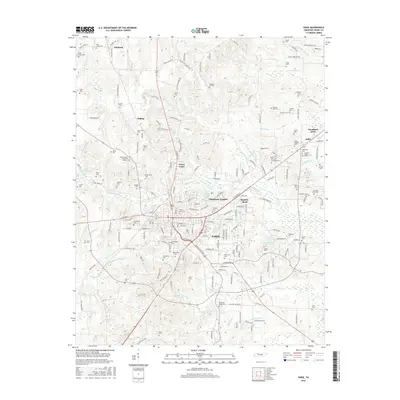
2016 Map of Paris
USGS Topo · Published 2016About this map
Paris serves as the focal point of this Henry County landscape, situated at the confluence of several local streams including McFadden Br and Twomile Br. The map details the transition from the urban center to outlying residential areas such as Chickasaw Heights, Meadow Mead, and Woodland Acres. For genealogists, this sheet is exceptionally dense with burial sites, covering a wide range of family and community landmarks from the large Paris City Cem and Maplewood Cem to smaller rural plots like Puckett Cem, Bevill Cem, and Dortch Cem. Water features define the periphery, with the Middle Fork Obion River cutting through the southwest and the winding path of Thompson Cr in the northeast. The road network connects older settlements like Whitlock and India to the county seat, providing a clear view of how the modern transportation corridors align with the region's historic topography.
Find a feature on this map
196 named features on this map. Tap any name to fly to it.
Don’t see what you’re looking for? This feature index may not catch every label — zoom into the map to look around manually.
Map Details
Editions of this 2016 Paris Map
This is the sole edition of this map. No revisions or reprints were ever made.
Other maps of this area

1936 · Conyersville
USGS Topo · 1:24,000

1936 · Buchanan
USGS Topo · 1:24,000

1936 · Crossland
USGS Topo · 1:24,000

1936 · Mansfield
USGS Topo · 1:24,000

1936 · Manleyville
USGS Topo · 1:24,000

1936 · Paris
USGS Topo · 1:24,000

1936 · Springville
USGS Topo · 1:24,000

1938 · Springville
USGS Topo · 1:24,000

1940 · Manleyville
USGS Topo · 1:24,000

1941 · Manleyville
USGS Topo · 1:24,000