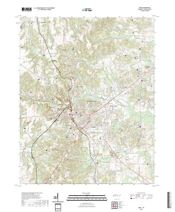
2022 Map of Paris
USGS Topo · Published 2022About this map
Paris serves as the focal point of this Henry County landscape, where the Henry County Courthouse and Tennessee College of Applied Technology anchor the town center. The area is defined by a dense network of residential and rural developments, reaching out to settlements like India, Whitlock, and Hilltop. To the south, the Middle Fork Obion River meanders through the terrain, joined by local waterways such as Clifty Cr and Greenbriar Cr.
Find a feature on this map
174 named features on this map. Tap any name to fly to it.
Don’t see what you’re looking for? This feature index may not catch every label — zoom into the map to look around manually.
Map Details
Editions of this 2022 Paris Map
This is the sole edition of this map. No revisions or reprints were ever made.
Other maps of this area

1936 · Conyersville
USGS Topo · 1:24,000

1936 · Buchanan
USGS Topo · 1:24,000

1936 · Crossland
USGS Topo · 1:24,000

1936 · Mansfield
USGS Topo · 1:24,000

1936 · Manleyville
USGS Topo · 1:24,000

1936 · Paris
USGS Topo · 1:24,000

1936 · Springville
USGS Topo · 1:24,000

1938 · Springville
USGS Topo · 1:24,000

1940 · Manleyville
USGS Topo · 1:24,000

1941 · Manleyville
USGS Topo · 1:24,000