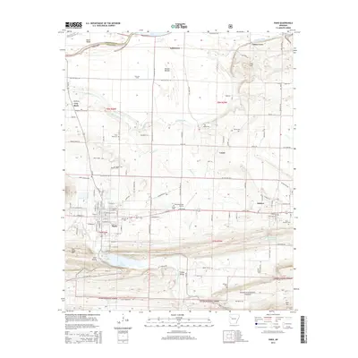
2014 Map of Paris
USGS Topo · Published 2014About this map
Paris serves as a central hub in Logan County, where the transition from the lowlands of McLean Bottom to the rising elevations of Pine Ridge Mtn and Rich Mtn is clearly marked. The town’s 21st-century footprint is defined by a traditional grid intersected by E Ar 22 HWY and the Ar 309 corridor, while the surrounding landscape reveals a deep history of land use, from the Paris Gas Field to the extensive timberlands of the Ozark National Forest. For genealogists and local historians, the sheet is exceptionally well-documented with family and community burial sites, including Oakwood Cem, Raney Cem, and Saint Benedict Cem near Subiaco. Water management is prominent through the Paris Reservoir and Subiaco Reservoir, supporting the dispersed settlements of Union, Gray Rock, and Kalamazoo along the winding course of Sixmile Creek.
Find a feature on this map
92 named features on this map. Tap any name to fly to it.
Don’t see what you’re looking for? This feature index may not catch every label — zoom into the map to look around manually.
Map Details
Editions of this 2014 Paris Map
This is the sole edition of this map. No revisions or reprints were ever made.
Other maps of this area

1879 · Mountain Home
USGS Topo · 1:62,500

1887 · Magazine Mountain #1
USGS Topo · 1:62,500

1887 · Magazine Mountain #4
USGS Topo · 1:62,500

1887 · Magazine Mountain #2
USGS Topo · 1:62,500

1887 · Magazine Mountain #3
USGS Topo · 1:62,500

1887 · Magazine Mountain
USGS Topo · 1:62,500

1890 · Magazine Mountain
USGS Topo · 1:125,000

1934 · Booneville
USGS Topo · 1:48,000

1939 · Booneville
USGS Topo · 1:62,500

1956 · Russellville
USGS Topo · 1:250,000