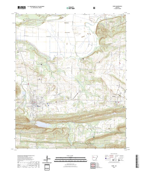
2024 Map of Paris
USGS Topo · Published 2024About this map
Logan County Courthouse serves as a central anchor in Paris, where the grid of city streets gives way to the ridges of the Ozark National Forest to the south. The landscape is defined by the east-west orientation of Pine Ridge Mtn and Rich Mtn, with the Paris Reservoir and Subiaco Reservoir tucked into the valley folds. To the east, the prominent Subiaco Abbey grounds stand near the settlement of Subiaco, illustrating the enduring religious and educational institutions of the Arkansas River Valley.
Find a feature on this map
75 named features on this map. Tap any name to fly to it.
Don’t see what you’re looking for? This feature index may not catch every label — zoom into the map to look around manually.
Map Details
Editions of this 2024 Paris Map
This is the sole edition of this map. No revisions or reprints were ever made.
Other maps of this area

1879 · Mountain Home
USGS Topo · 1:62,500

1887 · Magazine Mountain #1
USGS Topo · 1:62,500

1887 · Magazine Mountain #4
USGS Topo · 1:62,500

1887 · Magazine Mountain #2
USGS Topo · 1:62,500

1887 · Magazine Mountain #3
USGS Topo · 1:62,500

1887 · Magazine Mountain
USGS Topo · 1:62,500

1890 · Magazine Mountain
USGS Topo · 1:125,000

1934 · Booneville
USGS Topo · 1:48,000

1939 · Booneville
USGS Topo · 1:62,500

1956 · Russellville
USGS Topo · 1:250,000