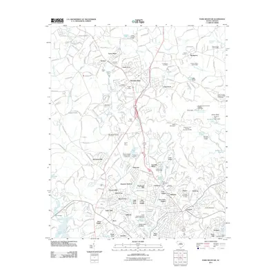
2011 Map of Paris Mountain
USGS Topo · Published 2011About this map
Travelers Rest serves as a central hub in this Upstate South Carolina landscape, where the Reedy River and Enoree River systems define the drainage and early settlement patterns. The map highlights a densely populated transition from the suburban outskirts of Greenville to the prominent elevation of Paris Mountain and Brissey Ridge. This 2011 survey documents a significant concentration of mid-to-late 20th-century residential growth, evidenced by numerous neighborhoods like Mountain Shadows, Berea, and Sans Souci Heights. Educational and recreational land use is prominent, anchored by the Furman University campus and its associated Furman Golf Course. For genealogists, the map is a detailed resource for local burial sites, preserving the locations of Ebenezer Cemetery, Grandview Cemetery, and the Reedy River Cemetery. The prevalence of small dams and named ponds, such as Swan Lake and Bruce Lake, illustrates the engineered water management characteristic of the region's Piedmont terrain.
Find a feature on this map
272 named features on this map. Tap any name to fly to it.
Don’t see what you’re looking for? This feature index may not catch every label — zoom into the map to look around manually.
Map Details
Editions of this 2011 Paris Mountain Map
This is the sole edition of this map. No revisions or reprints were ever made.
Other maps of this area

1888 · Pickens
USGS Topo · 1:125,000

1894 · Pickens
USGS Topo · 1:125,000

1905 · Pisgah
USGS Topo · 1:125,000

1906 · Pisgah
USGS Topo · 1:125,000

1907 · Saluda
USGS Topo · 1:125,000

1935 · Greenville
USGS Topo · 1:48,000

1938 · Greenville
USGS Topo · 1:62,500

1954 · Greenville
USGS Topo · 1:250,000

1955 · Knoxville
USGS Topo · 1:250,000

1957 · Greenville
USGS Topo · 1:24,000