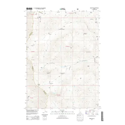
2013 Map of Paris Peak
USGS Topo · Published 2013About this map
Paris Peak and Bloomington Peak dominate this high-elevation landscape within the Cache National Forest, marking the spine of the Bear River Range. The terrain is defined by a series of steep drainages and alpine basins, including Paris Canyon and the headwaters of the Cub River. Historically significant paths like the German Dugway Rd and Bloomington Canyon Rd provide access through the complex topography, connecting established mountain flats such as Paris Flat, Telegraph Flat, and Horse Flat.
Find a feature on this map
57 named features on this map. Tap any name to fly to it.
Don’t see what you’re looking for? This feature index may not catch every label — zoom into the map to look around manually.
Map Details
Editions of this 2013 Paris Peak Map
This is the sole edition of this map. No revisions or reprints were ever made.
Other maps of this area

1909 · Montpelier
USGS Topo · 1:125,000

1911 · Montpelier
USGS Topo · 1:125,000

1915 · Preston
USGS Topo · 1:96,000

1918 · Preston
USGS Topo · 1:125,000

1955 · Preston
USGS Topo · 1:250,000

1958 · Preston
USGS Topo · 1:250,000

1962 · Preston
USGS Topo · 1:250,000

1967 · Paris
USGS Topo · 1:24,000

1967 · Ovid
USGS Topo · 1:24,000
1969 · Midnight Mtn
USGS Topo · 1:24,000