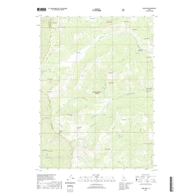
2020 Map of Paris Peak
USGS Topo · Published 2020About this map
Paris Peak rises as a central landmark within the high-elevation terrain of the Cache National Forest, straddling the county line between Franklin and Bear Lake Counties. This 2020 survey reveals a landscape defined by sharp elevation changes and high-mountain basins, including Green Basin and the aptly named Horseshoe Basin. A sophisticated network of forest development roads and specialized trails like the Shoshone Indian Trail and the Bloomington / Highline route provides access through the Bear River Range. Local water resources are plentiful at these heights, evidenced by Bloomington Lake and Limekiln Lake, which feed a series of drainage systems including the Middle Fork Bloomington Creek and Worm Creek. The map also captures several distinct flats, such as Paris Flat and Willow Flat, which served as critical level ground for early travel and grazing in the Idaho backcountry.
Find a feature on this map
56 named features on this map. Tap any name to fly to it.
Don’t see what you’re looking for? This feature index may not catch every label — zoom into the map to look around manually.
Map Details
Editions of this 2020 Paris Peak Map
This is the sole edition of this map. No revisions or reprints were ever made.
Other maps of this area

1909 · Montpelier
USGS Topo · 1:125,000

1911 · Montpelier
USGS Topo · 1:125,000

1915 · Preston
USGS Topo · 1:96,000

1918 · Preston
USGS Topo · 1:125,000

1955 · Preston
USGS Topo · 1:250,000

1958 · Preston
USGS Topo · 1:250,000

1962 · Preston
USGS Topo · 1:250,000

1967 · Paris
USGS Topo · 1:24,000

1967 · Ovid
USGS Topo · 1:24,000
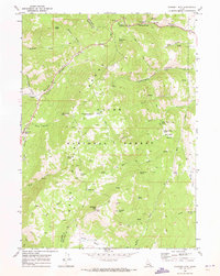
1969 · Midnight Mtn
USGS Topo · 1:24,000