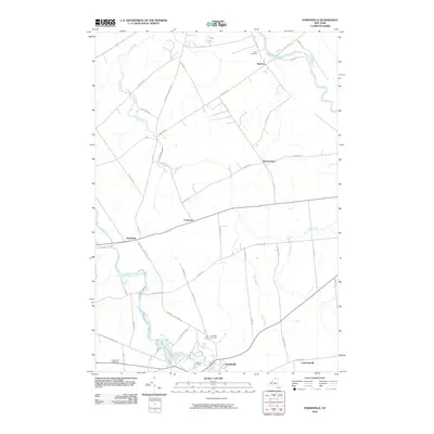
2010 Map of Parishville
USGS Topo · Published 2010About this map
The West Branch Saint Regis River snakes through this St. Lawrence County landscape, feeding the Allen Falls Reservoir and plunging over Allen Falls. This 2010 survey documents the rural character of the region, anchored by the village of Parishville in the south and smaller settlements like Buckton and Southville to the north and west. The topography is defined by the winding paths of Trout Brook and several smaller tributaries such as Dan Wright Brook and Rosenbarker Brook. For genealogists and local historians, the map identifies four significant burial grounds: Union Cemetery near Buckton, Fairview Cemetery and Hillcrest Cemetery near the Parishville center, and Chapel Hill Cemetery to the southwest. The road network remains largely rural, with routes like Parishville-Norfolk Rd and Buckton Rd connecting these historically distinct hamlets.
Find a feature on this map
50 named features on this map. Tap any name to fly to it.
Don’t see what you’re looking for? This feature index may not catch every label — zoom into the map to look around manually.
Map Details
Editions of this 2010 Parishville Map
This is the sole edition of this map. No revisions or reprints were ever made.
Other maps of this area

1906 · Massena
USGS Topo · 1:62,500

1907 · Massena
USGS Topo · 1:62,500

1908 · Potsdam
USGS Topo · 1:62,500

1915 · Moira
USGS Topo · 1:62,500

1917 · Moira
USGS Topo · 1:62,500

1919 · Nicholville
USGS Topo · 1:62,500

1921 · Nicholville
USGS Topo · 1:62,500

1942 · Long Bow
USGS Topo · 1:24,000

1942 · Norfolk
USGS Topo · 1:24,000

1943 · Potsdam
USGS Topo · 1:31,680