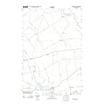
2013 Map of Parishville
USGS Topo · Published 2013About this map
Parishville anchors this northern New York landscape where the Saint Regis River and its branches carve through the countryside of Saint Lawrence County. The settlement pattern here is defined by small clusters like Buckton, Beechertown, and Converse, connected by a network of rural roads such as Old Forge Rd and Buckton Rd. The terrain is deeply marked by the hydrology of the area, including Trout Brook and Dan Wright Brook, which drain toward the larger river systems. Genealogists will find significant value in the distribution of local burial grounds, including Union Cem near the northern boundary, and the closely grouped Fairview Cem and Hillcrest Cem in the vicinity of Parishville. The map also captures the local infrastructure of the early 21st century, from the Po in the village center to the various routes like Co Rte 56 that weave through the woodlands and fields.
Find a feature on this map
65 named features on this map. Tap any name to fly to it.
Don’t see what you’re looking for? This feature index may not catch every label — zoom into the map to look around manually.
Map Details
Editions of this 2013 Parishville Map
This is the sole edition of this map. No revisions or reprints were ever made.
Other maps of this area

1906 · Massena
USGS Topo · 1:62,500

1907 · Massena
USGS Topo · 1:62,500

1908 · Potsdam
USGS Topo · 1:62,500

1915 · Moira
USGS Topo · 1:62,500

1917 · Moira
USGS Topo · 1:62,500

1919 · Nicholville
USGS Topo · 1:62,500

1921 · Nicholville
USGS Topo · 1:62,500

1942 · Long Bow
USGS Topo · 1:24,000

1942 · Norfolk
USGS Topo · 1:24,000

1943 · Potsdam
USGS Topo · 1:31,680