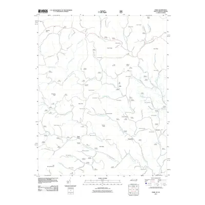
2011 Map of Park
USGS Topo · Published 2011About this map
Big Horse Creek and its many tributaries carve a dense network of hollows through this portion of North Carolina and Virginia. The 2011 landscape is defined by its deep genealogical roots, visible in the high density of family-named burial grounds like Baldwin Cemetery, Osborne Cemetery, and Blevins Cemetery that dot the ridges and valleys. Small settlements such as Nella, Apple Grove, and Tuckerdale serve as focal points for the rural community, while the presence of the Husk Post Office near Nella indicates a persistent local infrastructure. The terrain rises sharply toward Whitetop Gap in the northwest and Big Spring Mountain to the south, with prominent features like Whindling Ridge and Alley Knob shaping the winding path of local roads. This survey provides a clear view of the longstanding land divisions and family landmarks that characterize this Appalachian borderland.
Find a feature on this map
134 named features on this map. Tap any name to fly to it.
Don’t see what you’re looking for? This feature index may not catch every label — zoom into the map to look around manually.
Map Details
Editions of this 2011 Park Map
This is the sole edition of this map. No revisions or reprints were ever made.
Other maps of this area

1889 · Wytheville
USGS Topo · 1:125,000

1889 · Wilkesboro
USGS Topo · 1:125,000

1891 · Abingdon
USGS Topo · 1:125,000

1891 · Wilkesboro
USGS Topo · 1:125,000

1892 · Wytheville
USGS Topo · 1:125,000

1893 · Cranberry
USGS Topo · 1:125,000

1894 · Abingdon
USGS Topo · 1:125,000

1895 · Cranberry
USGS Topo · 1:125,000

1899 · Cranberry
USGS Topo · 1:125,000

1902 · Cranberry
USGS Topo · 1:125,000