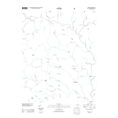
2013 Map of Park
USGS Topo · Published 2013About this map
Lansing and the surrounding high-country communities of Ashe County define this rural landscape near the Virginia border. The settlement pattern follows the intricate drainage network of the Big Horse Cr and Helton Cr, where small clusters like Apple Grove, Nella, and Tuckerdale are linked by winding routes such as Farmers Store Rd and Helton Creek Rd. The terrain is marked by significant elevations including Bluff Mountain and Big Spring Mountain, with the prominent Whitetop Gap providing a natural pass in the northwest. This 2013 survey illustrates a region where local geography is tied to narrow creek valleys and ridges like Baker Ridge and Flat Top Ridge, preserving a map of the traditional mountain homesteads and family-named hollows like Darnell Hollow and Hurley Hollow.
Find a feature on this map
118 named features on this map. Tap any name to fly to it.
Don’t see what you’re looking for? This feature index may not catch every label — zoom into the map to look around manually.
Map Details
Editions of this 2013 Park Map
This is the sole edition of this map. No revisions or reprints were ever made.
Other maps of this area

1889 · Wytheville
USGS Topo · 1:125,000

1889 · Wilkesboro
USGS Topo · 1:125,000

1891 · Abingdon
USGS Topo · 1:125,000

1891 · Wilkesboro
USGS Topo · 1:125,000

1892 · Wytheville
USGS Topo · 1:125,000

1893 · Cranberry
USGS Topo · 1:125,000

1894 · Abingdon
USGS Topo · 1:125,000

1895 · Cranberry
USGS Topo · 1:125,000

1899 · Cranberry
USGS Topo · 1:125,000

1902 · Cranberry
USGS Topo · 1:125,000