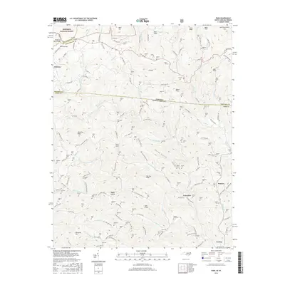
2016 Map of Park
USGS Topo · Published 2016About this map
Jefferson National Forest dominates the high-altitude terrain along the border of North Carolina and Virginia, providing a detailed view of the Blue Ridge mountain communities as they existed in 2016. The landscape is characterized by a dense network of family-named landmarks and hollows, including Darnell Hollow and Hurley Hollow. Small settlements like Apple Grove, Tuckerdale, and Lansing serve as nodes in a geography defined more by topography and water than by urban development. The proliferation of small burial grounds, such as Sabbath Home Cem and Fees Ridge Cem, indicates a deeply rooted genealogical history where families have remained attached to specific ridges and creeks for generations. This map captures the intricate drainage patterns of Helton Cr and the Middle Fork Horse Cr, which shaped the early paths and road systems through the gaps.
Find a feature on this map
167 named features on this map. Tap any name to fly to it.
Don’t see what you’re looking for? This feature index may not catch every label — zoom into the map to look around manually.
Map Details
Editions of this 2016 Park Map
This is the sole edition of this map. No revisions or reprints were ever made.
Other maps of this area

1889 · Wytheville
USGS Topo · 1:125,000

1889 · Wilkesboro
USGS Topo · 1:125,000

1891 · Abingdon
USGS Topo · 1:125,000

1891 · Wilkesboro
USGS Topo · 1:125,000

1892 · Wytheville
USGS Topo · 1:125,000

1893 · Cranberry
USGS Topo · 1:125,000

1894 · Abingdon
USGS Topo · 1:125,000

1895 · Cranberry
USGS Topo · 1:125,000

1899 · Cranberry
USGS Topo · 1:125,000

1902 · Cranberry
USGS Topo · 1:125,000