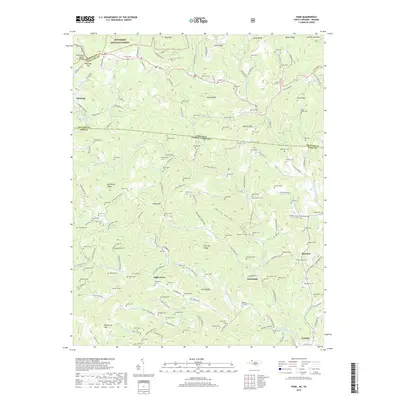
2019 Map of Park
USGS Topo · Published 2019About this map
Apple Grove and Tuckerdale anchor this high-elevation landscape where the Virginia-North Carolina state line crosses the Appalachian ridges. The terrain is defined by the Tennessee Valley Divide, with waters like Big Horse Creek and Little Horse Creek carving through deep valleys. This survey reveals a dense network of family cemeteries, including Bethel Cemetery, Hall Cemetery, and Pennington Cemetery, reflecting generations of settlement in the Blue Ridge. The northern reaches within the Jefferson National Forest include prominent peaks like Bluff Mountain and Haw Orchard Mountain. The historic Virginia Creeper route winds through the northwestern corner near Whitetop, tracing a path that historically connected these mountain communities. The concentration of cemeteries near Lansing and Brandon provides a detailed record of local kinship and the rural social fabric of Ashe County.
Find a feature on this map
171 named features on this map. Tap any name to fly to it.
Don’t see what you’re looking for? This feature index may not catch every label — zoom into the map to look around manually.
Map Details
Editions of this 2019 Park Map
This is the sole edition of this map. No revisions or reprints were ever made.
Other maps of this area

1889 · Wytheville
USGS Topo · 1:125,000

1889 · Wilkesboro
USGS Topo · 1:125,000

1891 · Abingdon
USGS Topo · 1:125,000

1891 · Wilkesboro
USGS Topo · 1:125,000

1892 · Wytheville
USGS Topo · 1:125,000

1893 · Cranberry
USGS Topo · 1:125,000

1894 · Abingdon
USGS Topo · 1:125,000

1895 · Cranberry
USGS Topo · 1:125,000

1899 · Cranberry
USGS Topo · 1:125,000

1902 · Cranberry
USGS Topo · 1:125,000