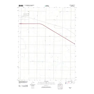
2009 Map of Park
USGS Topo · Published 2009About this map
Park sits in the northwest corner of this high plains landscape, organized around a geometric grid of county roads and historic transportation corridors. The small community is anchored by Sacred Heart Cemetery and a local street network including 5th St, situated just north of the modern interstate and the legacy route of Old Hwy 40. The terrain is defined by the subtle drainage patterns of the region, where Cow Draw and Plum Creek trend northeast while Big Creek meanders across the southern half of the quadrangle. This 2009 survey illustrates the enduring agricultural character of Gove County, where a vast system of secondary roads like Gove 62 and Gove AA partition the land into broad sections, maintaining the rural connectivity established by generations of Kansas farmers.
Find a feature on this map
23 named features on this map. Tap any name to fly to it.
Don’t see what you’re looking for? This feature index may not catch every label — zoom into the map to look around manually.
Map Details
Editions of this 2009 Park Map
This is the sole edition of this map. No revisions or reprints were ever made.
Other maps of this area

1954 · Goodland
USGS Topo · 1:250,000

1955 · Scott City
USGS Topo · 1:250,000

1956 · Goodland
USGS Topo · 1:250,000

1957 · Goodland
USGS Topo · 1:250,000

1958 · Scott City
USGS Topo · 1:250,000

1972 · Gove NE
USGS Topo · 1:24,000

1972 · Castle Rock NW
USGS Topo · 1:24,000

1972 · Gove
USGS Topo · 1:24,000

1979 · Park
USGS Topo · 1:24,000

1979 · Midway Draw West
USGS Topo · 1:24,000