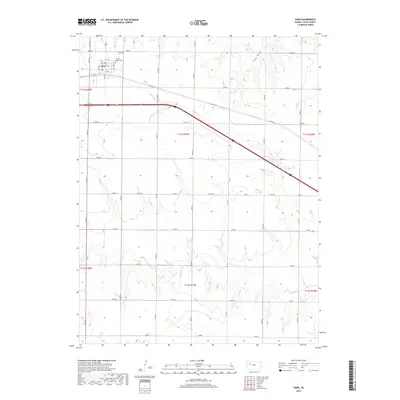
2018 Map of Park
USGS Topo · Published 2018About this map
The town of Park serves as the primary hub in this portion of Gove County, where the grid of city streets meets the wide agricultural expanse of the High Plains. Located in the northwestern corner of the sheet, the town’s layout reflects the influence of the railroad and early highway development, with the community situated just south of the tracks. The surrounding landscape is defined by subtle drainage patterns, notably the path of Cow Draw to the north and the meandering Plum Cr to the east. These intermittent waterways and draws provide the primary relief in an otherwise flat, productive prairie. The transition from the established street grid of the town to the systematic section line roads illustrates the late-20th and early-21st-century agricultural organization that continues to define this region of Kansas.
Find a feature on this map
3 named features on this map. Tap any name to fly to it.
Don’t see what you’re looking for? This feature index may not catch every label — zoom into the map to look around manually.
Map Details
Editions of this 2018 Park Map
This is the sole edition of this map. No revisions or reprints were ever made.
Other maps of this area

1954 · Goodland
USGS Topo · 1:250,000

1955 · Scott City
USGS Topo · 1:250,000

1956 · Goodland
USGS Topo · 1:250,000

1957 · Goodland
USGS Topo · 1:250,000

1958 · Scott City
USGS Topo · 1:250,000

1972 · Gove NE
USGS Topo · 1:24,000

1972 · Castle Rock NW
USGS Topo · 1:24,000

1972 · Gove
USGS Topo · 1:24,000

1979 · Park
USGS Topo · 1:24,000

1979 · Midway Draw West
USGS Topo · 1:24,000