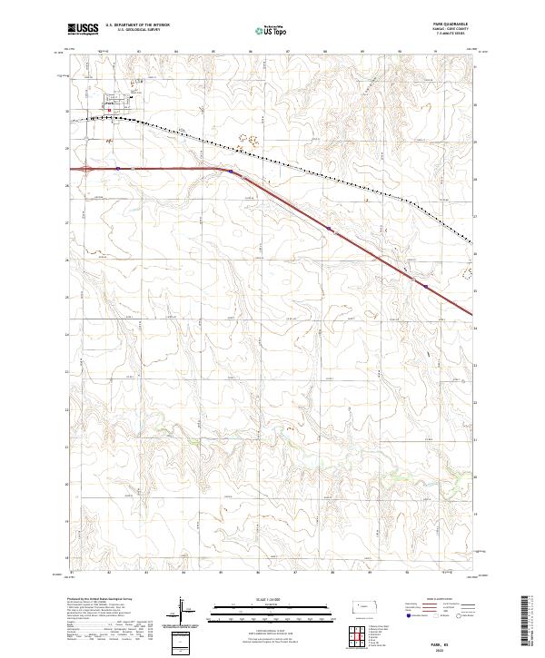
2022 Map of Park
USGS Topo · Published 2022About this map
The small town of Park serves as the focal point of this Gove County landscape, organized around a classic residential grid and the transit corridor of Old Hwy 40. Local history and genealogy interest is centered on the northern edge of the settlement at Sacred Heart Cem, located near the intersection of Main St and 1st St. Beyond the town limits, the terrain is defined by a series of intermittent drainage systems, including the prominent Big Cr winding through the southern sections and Cow Draw to the northeast. The map reveals the persistent influence of the Public Land Survey System, with township and range lines like t11s r27w dictating the placement of county roads and agricultural boundaries. This network of section lines creates a structured rural landscape where the natural flow of Plum Cr provides a subtle contrast to the rigid geometry of the Kansas plains.
Find a feature on this map
21 named features on this map. Tap any name to fly to it.
Don’t see what you’re looking for? This feature index may not catch every label — zoom into the map to look around manually.
Map Details
Editions of this 2022 Park Map
This is the sole edition of this map. No revisions or reprints were ever made.
Other maps of this area

1954 · Goodland
USGS Topo · 1:250,000

1955 · Scott City
USGS Topo · 1:250,000

1956 · Goodland
USGS Topo · 1:250,000

1957 · Goodland
USGS Topo · 1:250,000

1958 · Scott City
USGS Topo · 1:250,000

1972 · Gove NE
USGS Topo · 1:24,000

1972 · Castle Rock NW
USGS Topo · 1:24,000

1972 · Gove
USGS Topo · 1:24,000

1979 · Park
USGS Topo · 1:24,000

1979 · Midway Draw West
USGS Topo · 1:24,000