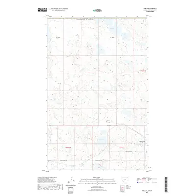
2020 Map of Park Lake
USGS Topo · Published 2020About this map
Comertown sits at the southern edge of this Sheridan County landscape, where the agricultural grid meets the international boundary between the United States and Canada. This 2020 survey documents a glaciated prairie environment defined by alkaline depressions and intermittent water bodies. The terrain is notably marked by Salt Lake in the north and its namesake Park Lake further south, both part of a larger network of prairie potholes. Local history is anchored by the presence of the McCall - Gibson Cem along Salt Lake Rd and the Dooley Cem further west. These sites, along with the route of the Comertown-Dooley Rd, provide essential points of reference for genealogists and local historians tracing the settlement patterns and family heritage of this borderland region.
Find a feature on this map
15 named features on this map. Tap any name to fly to it.
Don’t see what you’re looking for? This feature index may not catch every label — zoom into the map to look around manually.
Map Details
Editions of this 2020 Park Lake Map
This is the sole edition of this map. No revisions or reprints were ever made.
Other maps of this area

1954 · Wolf Point
USGS Topo · 1:250,000

1958 · Wolf Point
USGS Topo · 1:250,000

1983 · Dooley
USGS Topo · 1:24,000

1983 · Tadpole Lake
USGS Topo · 1:24,000

1983 · Dooley SW
USGS Topo · 1:24,000

1983 · Dooley SE
USGS Topo · 1:24,000

1983 · Lone Tree Lake
USGS Topo · 1:24,000

1983 · Park Lake
USGS Topo · 1:24,000
2011 · Dooley
USGS Topo · 1:24,000
2011 · Dooley SW
USGS Topo · 1:24,000