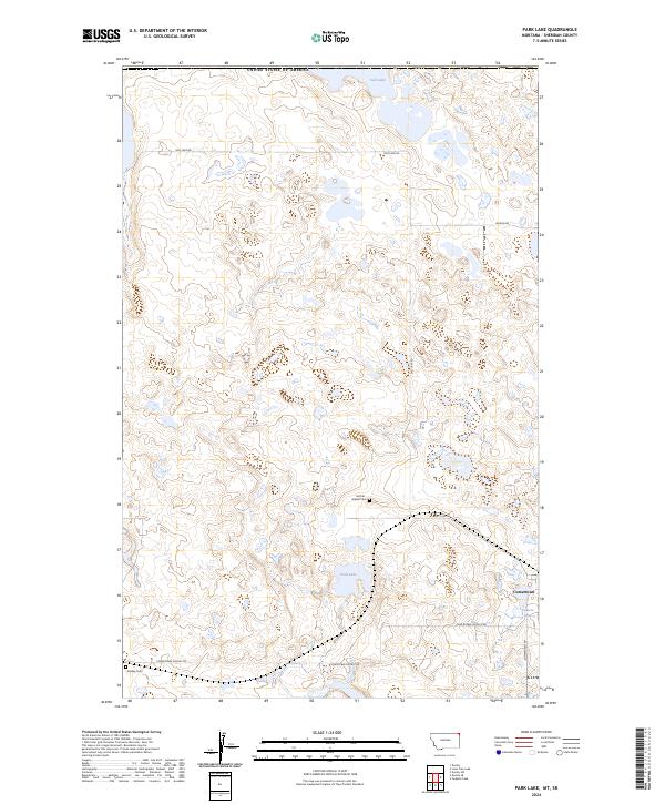
2024 Map of Park Lake
USGS Topo · Published 2024About this map
Sheridan County's high plains near the Canadian border are defined by a scattered network of shallow basins and conservation lands. The extensive Sheridan County Waterfowl Production Area dominates the northern and central portions of the map, protecting the prairie pothole ecosystem surrounding Salt Lake and Park Lake. These water bodies and wetlands reflect the glaciated landscape typical of this portion of northeast Montana, where drainage is often internal and the terrain is punctuated by small, name-bearing depressions like Comers Lake.
Find a feature on this map
16 named features on this map. Tap any name to fly to it.
Don’t see what you’re looking for? This feature index may not catch every label — zoom into the map to look around manually.
Map Details
Editions of this 2024 Park Lake Map
This is the sole edition of this map. No revisions or reprints were ever made.
Other maps of this area

1954 · Wolf Point
USGS Topo · 1:250,000

1958 · Wolf Point
USGS Topo · 1:250,000

1983 · Dooley
USGS Topo · 1:24,000

1983 · Tadpole Lake
USGS Topo · 1:24,000

1983 · Dooley SW
USGS Topo · 1:24,000

1983 · Dooley SE
USGS Topo · 1:24,000

1983 · Lone Tree Lake
USGS Topo · 1:24,000

1983 · Park Lake
USGS Topo · 1:24,000
2011 · Dooley
USGS Topo · 1:24,000
2011 · Dooley SW
USGS Topo · 1:24,000