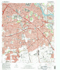
1982 Map of Park Place
USGS Topo · Published 1995About this map
William P Hobby Airport anchors the southern landscape of this southeast Houston region, illustrating the intense urban and industrial development along the Texas Gulf Coast. The map detail highlights the complex infrastructure required for a major metropolitan hub, from the dense network of the Houston Belt and Terminal RR to the convergence of the Gulf Freeway and South Loop. Educational institutions like Texas Southern University and the University of Houston appear alongside numerous neighborhood schools and the expansive Forest Park Cemetery. The winding courses of Buffalo Bayou and Brays Bayou contrast with the heavy industrial character of the Turning Basin and the Manchester district. This survey also records the presence of the Municipal Prison Farm and various public parks including Emancipation Park and Mac Gregor Park, documenting the mid-century spatial organization of the city.
Find a feature on this map
84 named features on this map. Tap any name to fly to it.
Don’t see what you’re looking for? This feature index may not catch every label — zoom into the map to look around manually.
Map Details
Editions of this 1982 Park Place Map
2 editions found
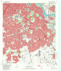
Other maps of this area

1915 · Bellaire
USGS Topo · 1:24,000

1915 · Park Place
USGS Topo · 1:24,000

1915 · Houston Heights
USGS Topo · 1:24,000

1915 · Deepwater
USGS Topo · 1:24,000

1916 · Genoa
USGS Topo · 1:24,000

1916 · Settegast
USGS Topo · 1:24,000

1916 · Fauna
USGS Topo · 1:24,000

1919 · Deepwater
USGS Topo · 1:31,680

1920 · Genoa
USGS Topo · 1:31,680
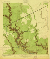
1920 · Fauna
USGS Topo · 1:31,680